
by Katherine O. Rizzo (first published in the January 2024 Equiery)
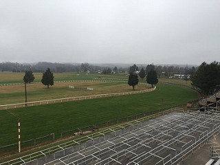
Pocomoke River State Park is tucked away on Maryland’s lower Eastern Shore in Worcester County. It is best known for the vast cypress swamps that border the Pocomoke River. The river starts in the Great Cypress Swamp in Delaware and flows southwesterly for 45 miles before emptying into the Chesapeake Bay. The Pocomoke River State Park is within the 18,000-acre Pocomoke State Forest. Both the state park and state forest offer multi-use trails; however, most of the trails within the state park are restricted to foot traffic. The state forest has several miles of trails open to horseback riding.
The state park, which is open year-round from sunup to sundown, is a popular spot for fishing, biking, bird watching, boating, hiking, and camping. Park amenities include cabins as well as tent camping sites, two boat launches, picnic areas and shelters, playgrounds, and a swimming pool.
Pocomoke State Forest stretches across Somerset, Wicomico and Worcester counties with its main office located in Worcester County. Most of the park is in Worcester County between Snow Hill and Pocomoke City, with smaller parcels in Wicomico and Somerset. The state forest is characterized by large areas of loblolly pines, mixed pine/hardwoods, bottomland hardwoods and bald-cypress swamps. Five areas within the state forest are designated Wildlands areas.
The land within the state forest was originally cleared for farming, but during the Great Depression many farmers sold their properties to the Federal Government. In the mid to late 1930s, two Civilian Conservation Camps were located within the state forest, with camp workers creating roads and trail systems. They also planted trees and created recreation amenities.
The state forest is home to 25 miles of multi-use trails. The trail system varies in terrain but is generally flat with occasional stream or road crossings. Horseback riding is allowed on all maintained forest trails and roads designated for recreational use. Most of the parking lots can accommodate horse trailers. Note that the Pocomoke State Forest ORV Trails have been permanently closed.
Trail guides and maps are available for purchase at the park office. Park users are reminded to wear blaze orange during hunting season.
The main trails within the state forest are:
• Chandler Tract Trail – 6.8 miles of trails with multiple loops. Parking for this trail system is off Worcester Highway (US 113) directly across from the Shad Landing area of Pocomoke River State Park. The largest loop of this trail system is marked with green paint and is 4.4 miles starting from the south parking lot. An additional 1.7-mile blue trail loop begins at the northeastern edge of the green loop. There is also a 1.5-mile white trail that begins at the south parking lot and ends at Corker’s Creek.
• Colburne Tract Trail – A shorter 1.9-mile loop marked with red paint. Parking is located off Onley Road about 1.25 miles from the intersection with Betheden Church Road. This loop also has a short “white spur trail” that begins at the northeast corner of the red loop trail and leads towards Corker’s Creek.
• Hudson-Tarr Bike Trail – This 8.5-mile network of trails was designed for single-track mountain bikes but is open to all uses. It is marked by blue, green, white and yellow paint and winds through the Hudson and Tarr tracts of the state forest. Parking is across from the trail head on Blades Road.
• Milburn Landing Trail – The 3.7-mile loop trail is located next to the Milburn Landing area of Pocomoke River State Park. The loop travels through upland pine and hardwood forests as well as bald cypress bottomlands. About 2.2 miles of this trail is shared with the Algonquin Cross County Trail. Horses and bikes are only allowed on the shared portions of this trail. Parking is available on Camp Road, Nassawango Road or in the state park.
• Red Furnace Loop – This 6.2- mile loop trail is the longest in the Old Furnace Loop Trails network. It connects Furnace Town with the Algonquin Cross Country Trail. This trail offers a variety of landscapes including inland sand dunes, low land swamps and pine flats. It also connects with the Orange and Yellow Furnace loops.
• Orange Furnace Loop – The trail head for this 3.9-mile loop is at the intersection of the Algonquin Cross Country Trail and Forest Road. An additional 0.6 miles of the trail are on Forest Road to complete the loop.
• Yellow Furnace Loop – This is the smallest of the Furnace trails – only 1.8 miles. The trail passes through a rare shortleaf pine and mixed oak forest that developed on an inland sand dune.
• Pusey Brank Trail – This 0.6-mile loop trail is open to foot traffic only. It is located approximately four miles west of Furnace Town near the intersection of Old Furnace and Old Beech Roads. The trail features interpretive waypoints that provide hikers with additional information about the various trees and wildlife within the forest and those found throughout the Eastern Shore of Maryland.


